
The Majority Of NOAA Land Temperature Data Is Fake
Posted: August 18, 2015 Filed under: Uncategorized Leave a commentThe animation below flashes between the land portion of NOAA’s global temperature map, and their actual measured regions of temperature. Missing areas (like most of Africa, Greenland, Antarctica and Canada) are gray.
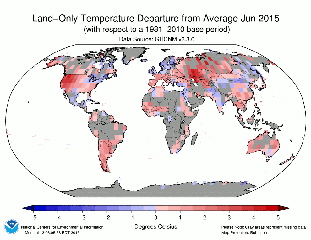
As you can see, most of their land data is fake. Then these fraudsters declare it to be the hottest month on record by a couple of hundredths of a degree.
Your tax dollars at work by climate criminals pushing propaganda for the White House.


Recent Comments